
Engaging Task Force Members in Field Data-Based Assessments
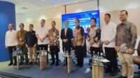
JAKARTA, PELAKITA.ID – The Ministry of Marine Affairs and Fisheries (KKP) is strengthening the process of selecting prospective sites for the 2027 Red and White Fishing Village (KNMP) program through a Training of Trainers (ToT) initiative for Task Force members, equipping them to deliver similar training to assessment partners.
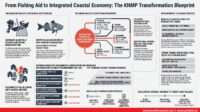
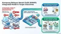
The initiative aims to ensure that the identification and assessment of prospective sites are conducted systematically, using measurable indicators and field-based data, while taking into account community needs, land readiness, fisheries potential, and support from local governments.
The training, which began on Thursday, October 15, 2026, focused on policy orientation and data collection techniques.
The activity forms part of preparations to align the understanding of Task Force members and assessment partners regarding the direction of KNMP policy, the framework for preparing prospective sites, the scope of work, and survey methods for gathering information from communities.
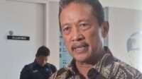
KKP Director of Fisher Protection and Empowerment, Dr. Ady Candra, emphasized the importance of evaluating lessons from KNMP development in 2025–2026 as a basis for improving planning for the following year.
Various challenges encountered during program implementation need to be anticipated at the site identification stage so that they do not develop into obstacles once physical construction is underway.
“We need to prepare properly and make use of previous experience so that planning for the 2027 KMP program can proceed well and, of course, deliver benefits,” Ady Candra emphasized during the opening session of the ToT.
According to him, the challenges of developing fishing villages extend beyond completing infrastructure. They also include ensuring land ownership and legal status, compliance with spatial planning, appropriate designs, the readiness of supporting facilities, and communities’ capacity to make effective use of the facilities being built.
Strengthening the Foundations of Planning from the Survey Stage
The next presentation was delivered by Dr. Ilham, who explained the partnership context, the roles and scope of work of assessment partners, expected deliverables, cooperation mechanisms, and implementation schedules.
The presentation was intended to ensure that every partner understands their responsibilities and the standards their assessment results must meet.
Ilham noted that data quality is a fundamental concern in planning the 2027 KNMP program because development recommendations will determine site selection, facility scale, and the type of intervention required.
Administrative data provided by local governments must be re-examined through direct field surveys to ensure that decisions are based not merely on proposals but also on actual conditions on the ground.
Ilham warned that problems can arise when preliminary information does not match field conditions. A site declared available, for example, may have unresolved legal ownership issues, inconsistencies with spatial planning regulations, or access constraints that only become apparent after construction has begun.
Other risks include sites located too far from fishing activity centers, inadequate land-grant documentation, discrepancies in material prices and quality, and limited logistical access to remote areas and small islands.
Assessment partners therefore need to verify the number of fishing vessels, the number of active fishers, production volumes, infrastructure availability, road access, and market potential. This information also helps determine whether a site is suitable for development as a fisheries activity center or hub, or would be better suited to serving as a supporting area.
Planning Must Be Grounded in Verification and Site-Specific Needs
Mohammad Abdi, Chair of the Task Force for the Preparation and Planning of KNMP 2027, identified the assessment and verification of prospective sites as crucial stages in preparing for development in 2027.
He emphasized that planning must begin well before construction so that land-related issues, technical readiness, and community needs can be identified and addressed from the outset.
Within this preparatory framework, assessments conducted by universities and non-governmental organizations (NGOs) are expected to produce reliable, verifiable information to support the preparation of site profiles, Detailed Engineering Designs (DEDs), and cost estimates, known as the Rencana Anggaran Biaya (RAB).
Consistency between survey findings and planning documents is essential to ensure that the facilities designed are genuinely appropriate for the sites assessed.
Preparations for the 2027 development program also include a target of completing DEDs for 1,000 sites no later than December 31, 2026. Meeting this target requires coordinated scheduling of site identification, data collection, supporting-evidence checks, and the preparation of planning documents.
Abdi also emphasized that KNMP interventions cannot be standardized across all locations. Capture fisheries, aquaculture, marine tourism, conservation areas, and inland waters have different characteristics that must be considered in accordance with their respective potential, needs, and local conditions.
Assessment, therefore, is not merely an administrative process for determining where construction should take place.
It must explain why a particular site is prioritized, which issues need to be resolved, what facilities are required, and what support must be put in place to ensure that development functions sustainably.
Facilitation, Observation, Interviews, and Focus Group Discussions
Capacity-building for Task Force members began with explanations of assessment procedures, implementation stages, and data collection requirements delivered by Dr. Iwan Muliawan and Dr. Frdaus from the Agency for Marine and Fisheries Human Resources Research and Development (BRSDM KP). The program then continued with a session on survey methodology and data collection facilitated by Kamaruddin Azis, Baso Syaifuddin, and Dr. Simon Boyke Sinaga.
The material covered facilitation and community assistance techniques, field observation, interviews, and focus group discussions (FGDs).
This session positioned communities as a primary source of information for identifying local needs, problems, potential, and development priorities. A participatory approach is necessary to ensure that the data collected reflects not only administrative perspectives but also fishers’ experiences and the socioeconomic conditions of the target locations.
The aspects to be identified include land status and availability, the readiness of community institutions, supporting facilities and infrastructure, KNMP intervention needs, and the forms of support required from local governments. Findings are to be documented in official minutes using a prepared template as part of the assessment records.
Through direct observation, teams can examine the physical conditions and accessibility of prospective sites. Interviews help gather information from village governments, fishers, business operators, and other stakeholders, while FGDs provide a forum for discussing shared concerns and identifying community-agreed priorities.
The combination of these methods is expected to produce a more comprehensive picture of site suitability. If discrepancies emerge between administrative documents and information provided by community members, they must be followed up through supporting-evidence checks and field verification.
Technical readiness must also be examined from the outset, including access to clean water, electricity supply, roads, material quality, and mechanical, electrical, and plumbing requirements. At the same time, coordination with local governments, the state electricity company PLN, Pertamina Patra Niaga, the Ministry of Agrarian Affairs and Spatial Planning/National Land Agency (ATR/BPN), and other relevant institutions is necessary to anticipate legal, technical, and operational obstacles.
Beyond infrastructure readiness, community education and assistance are essential to ensuring that facilities are used optimally. Post-harvest technologies and cold-chain systems, for example, require adequate user understanding and preparedness to deliver tangible benefits in maintaining catch quality and increasing market value.
Through this training, KKP seeks to strengthen assessment partners’ capacity to identify problems, verify data, formulate technical recommendations, and anticipate development risks. The findings are expected to provide a more accurate basis for planning while helping align community needs with the designs and infrastructure support to be prepared.
For Mohammad Abdi and the Task Force for the Preparation and Planning of KNMP 2027, consistency between surveys, verification, and technical documentation is a crucial part of development preparation. Meanwhile, Ady Candra’s emphasis on learning from implementation in 2025–2026 underscores the need to identify potential problems before construction begins.
Both perspectives point to one fundamental requirement: every development decision must be supported by verifiable data and aligned with the needs of the area concerned.
With this approach, KNMP is expected not only to deliver new infrastructure but also to strengthen fisheries-based economic activities and improve the welfare of coastal communities.
Editorial Team