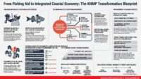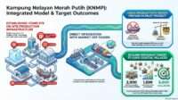

From baseline data and rigorous site verification to community participation, Indonesia’s Kampung Nelayan Merah Putih 2027 program is strengthening the foundations of targeted, accountable, and sustainable coastal development.
MARITIMEPOSTS.COM — The success of a development program is determined long before construction begins. It starts with understanding the real conditions of the communities it seeks to serve, identifying their needs and economic potential, and ensuring that public investments are directed toward locations where they can generate meaningful and sustainable benefits.
This principle underpins the Ministry of Marine Affairs and Fisheries (Kementerian Kelautan dan Perikanan/KKP) in preparing the 2027 Kampung Nelayan Merah Putih (KNMP) program.
Rather than relying solely on administrative proposals, geographical proximity to the sea, or assumptions about a village’s readiness, KKP is strengthening its planning process through systematic field assessments, verifiable evidence, and a common methodology for evaluating prospective locations.
Through the Task Force for Preparation and Planning of KNMP 2027, KKP is establishing a more rigorous foundation for determining which fishing villages are eligible, what challenges they face, and what interventions are most appropriate to support their development.
The approach reflects an important shift in development planning: decisions about where and how to invest must be grounded in the actual circumstances of coastal communities, not simply in what is reported on paper.
Building a Common Methodology Before Entering the Field
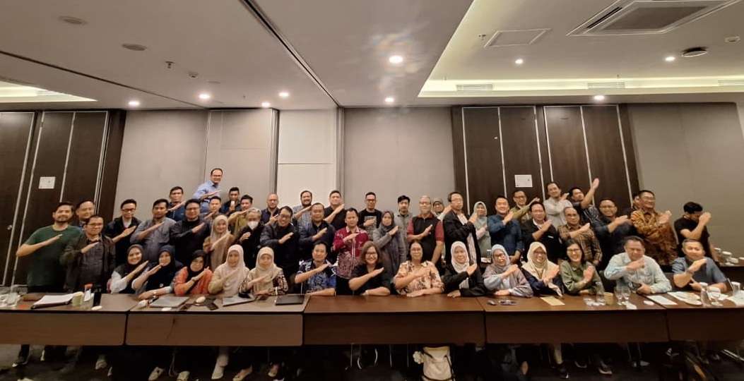
To prepare for the assessment process, KKP organized an intensive four-day Training of Trainers (ToT) in Jakarta, involving 62 members of the KNMP 2027 Task Force representing seven strategic regions.
The activity was conducted under the direction of the task force chaired by Senior Expert Mohammad Abdi. Senior policy experts, including Dr. Irwan Muliawan and Dr Maulana Firdaus, from the BPPSDMKP KKP, contributed to establishing the methodological framework, while facilitators Baso Syaifuddin and senior experts Hartono addressed key aspects of field assessment, evidence verification, scoring, and data quality.
The ToT serves a purpose beyond technical training. It establishes a shared understanding among assessment teams so that different regions apply consistent standards when evaluating prospective KNMP locations.
Without a common methodology, the same village conditions could be interpreted differently by different assessors. One team might consider a cooperative operational because it has a legal registration and a physical office, while another might examine whether it has active members, conducts transactions, and holds regular meetings.
Similarly, a village may appear to have adequate basic infrastructure on administrative records, yet residents may still experience seasonal shortages of clean water or difficulties accessing fuel.
By standardizing assessment procedures, KKP seeks to reduce these inconsistencies and ensure that decisions are based on comparable, verifiable information.
The central principle is straightforward: field conditions must be recorded as they are, including their limitations, challenges, and potential. The objective is not to make every proposed location appear ready for development, but to identify its actual readiness and the interventions required to improve it.
Six Eligibility Requirements: Establishing the Foundations of Readiness
One of the most important elements of the KNMP 2027 assessment framework is the distinction between meeting fundamental eligibility requirements and receiving a quantitative score.
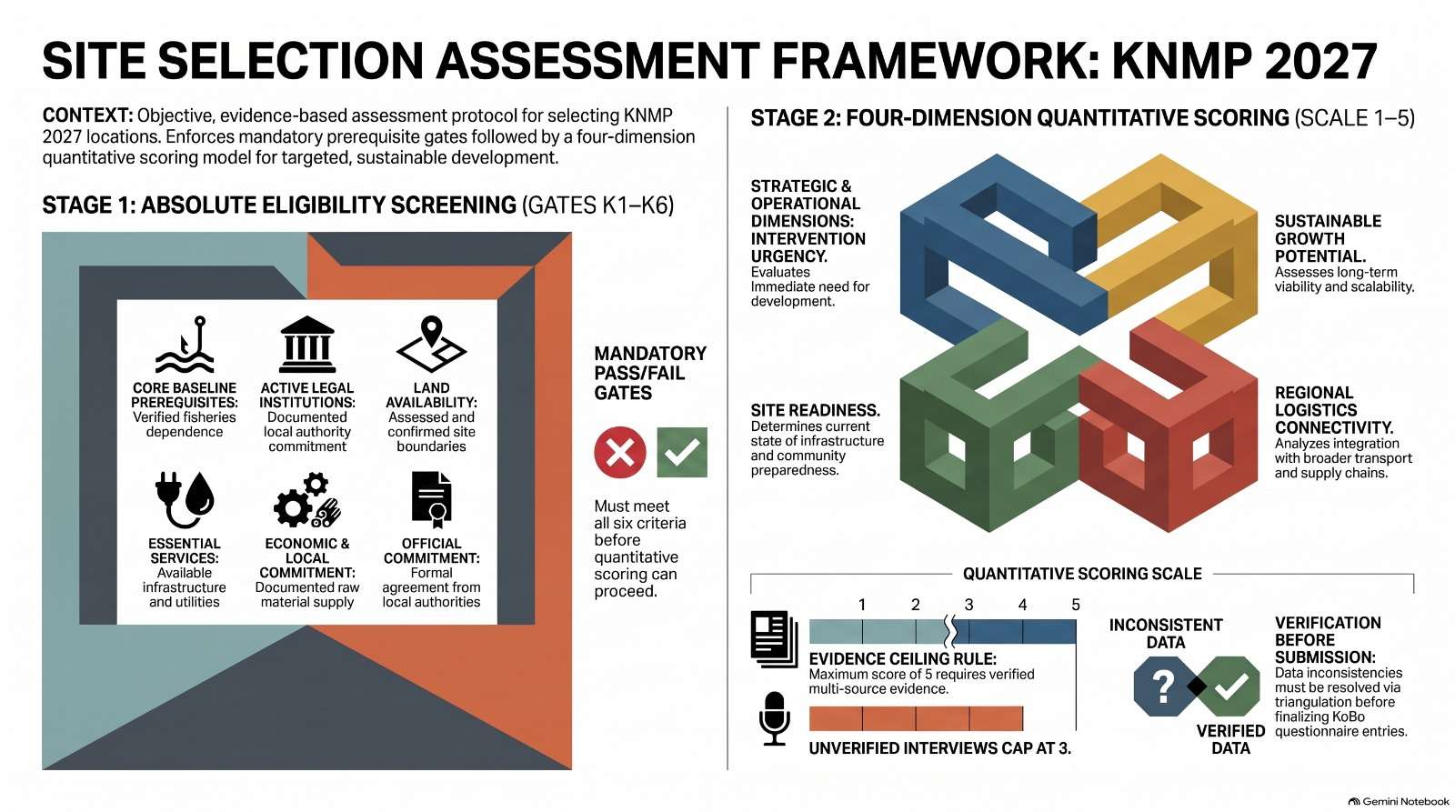
Before a prospective location is evaluated across four assessment dimensions, it must pass six mandatory eligibility requirements, designated K1 through K6. These requirements establish whether a location meets the basic conditions necessary for further consideration.
At this stage, assessors do not assign numerical scores. Instead, each criterion is classified as Memenuhi (M), meaning it meets the requirement, or Tidak Memenuhi (TM), meaning it does not. When the available evidence is incomplete, assessors may temporarily record Butuh Data Verifikasi (BDV), or data requiring further verification.
However, BDV is not a final determination. Every outstanding verification status must be resolved into M or TM before the assessment is submitted. An unresolved failure under the sixth eligibility criterion, K6, results in disqualification under the framework described in the training material.
The six requirements cover the essential foundations of a viable fishing village development program.
First, the community’s fisheries-based livelihood must be verified.
Under K1, assessors examine whether the local economy genuinely depends on marine and fisheries activities. Official records, including KUSUKA and village profiles, must be cross-checked against observations in the field.
The assessment also requires careful deduplication of data. Individuals who work across multiple fisheries-related subsectors, such as fishing and seafood processing, must not be counted more than once where the figures represent the same person. This is important because an inaccurate picture of the beneficiary population can distort the assessment of local needs and the scale of intervention required.
Second, local economic institutions must be operational, not merely registered.
K2 examines the existence and functioning of economic institutions, such as cooperatives or village-owned enterprises (BUMDes). Legal documentation, including relevant records from the Ministry of Law and Human Rights or notarial deeds, provides evidence of institutional legitimacy.
But legal status alone is insufficient. Assessors must also examine membership records, minutes of the Annual Members Meeting (Rapat Anggota Tahunan or RAT), and evidence of financial transactions.
The distinction matters because an institution that exists only on paper may be unable to manage facilities, organize fishers, support collective marketing, or sustain economic activities after infrastructure is delivered.
Third, land must be legally secure and physically ready.
Under K3, prospective sites must have land that is available for development, free from ownership disputes, and physically suitable for construction.
Assessment teams must inspect the location directly and document their findings through photographs containing geographic coordinates, captured using location-enabled camera applications. Verbal assurances or informal agreements are not accepted as substitutes for verifiable evidence.
This requirement helps identify potential land-related obstacles before public investment is committed, reducing the risk of delays, disputes, or projects that cannot proceed as planned.
Fourth, essential services must be accessible throughout the year.
K4 examines the availability of electricity, clean water, and fuel or bahan bakar minyak (BBM).
The assessment goes beyond determining whether these services exist. Teams must consider travel distances, transportation arrangements, and the continuity of supply throughout all 12 months of the year.
A village may have access to a water source but still experience shortages during the dry season. Fuel may be available in a neighboring settlement but difficult or expensive to obtain. Such conditions can directly affect fishing operations, household welfare, and the viability of economic activities.
Fifth, the village must demonstrate real economic potential.
K5 focuses on existing production activities and the availability of raw materials across capture fisheries, aquaculture, and processing.
Assessors are expected to observe actual production and distribution activities, including fish landing sites, processing facilities, and distribution points. The aim is to establish whether a viable production chain already exists and what opportunities there are to strengthen it.
Rather than relying on optimistic projections, the assessment seeks to understand the economic activities that can realistically support the utilization of future KNMP facilities.
Sixth, institutional and community commitment must be demonstrated.
K6 examines the readiness of local government institutions and the fishing community to support implementation.
Evidence may include official letters of support, concrete work plans, and dedicated budget allocations. Community readiness must also be explored through structured interviews with fishers and other primary beneficiaries.
This requirement recognizes that successful development depends not only on physical infrastructure but also on the commitment of the institutions responsible for implementation and the people expected to use and benefit from the facilities.
Taken together, these six requirements provide an initial picture of whether a proposed location has the fundamental conditions necessary for the KNMP program to proceed.
Evidence-Based Scoring: Why Promising Claims Are Not Enough
Passing the eligibility stage does not eliminate the need for careful evaluation. The next challenge is determining how well each prospective location performs across the four assessment dimensions.
To strengthen the objectivity of this process, the KNMP 2027 methodology introduces an important quality-control principle: the evidence ceiling, or batas bukti.
Presented by ToT facilitator Baso Syaifuddin, the principle establishes that the maximum score for an indicator must reflect the strength and completeness of the supporting evidence. A location cannot receive a high score simply because its prospects appear promising or because local stakeholders express strong optimism about its future.
Under the framework outlined in the training material, a score of 5 is reserved for indicators supported by strong, triangulated evidence. This includes official documentation, geotagged photographs, and direct field observations that corroborate one another.
A score of 4 may be appropriate when primary evidence is sufficient and cross-verified, although minor gaps remain in supplementary documentation.
Where an assessment relies exclusively on interview testimony or a single source of opinion without physical verification or supporting documents, the maximum score is 3.
This approach places evidence quality at the center of the assessment process. It encourages field teams to distinguish between what is known, what has been verified, and what remains uncertain.
For example, a village might report that it has an active fisheries cooperative. If the cooperative’s legal documents, membership records, financial transactions, and actual activities support that claim, the assessment can reflect the strength of the evidence. If the only available proof is a statement from a local official, the score must remain within the applicable evidence ceiling.
The same principle applies to production volumes, access to basic services, land readiness, and community participation.
The broader significance is substantial. By linking scores to verifiable evidence, KKP can reduce the risk of inflated assessments and improve the credibility of comparisons between proposed locations.
It also reinforces an important distinction in public planning: a community’s development potential should be recognized, but potential must not be confused with existing readiness.
Resolving Contradictory Information Through Triangulation
Field assessments rarely produce perfectly consistent information. Different stakeholders may have different experiences, interests, and understandings of local conditions.
A village head, for instance, may report that clean water is available throughout the year. Fishers, however, may explain that during the dry season they must obtain water from another area at considerable expense.
Such contradictions are not merely administrative inconveniences. They can reveal gaps between official records and everyday community experiences.
The KNMP 2027 assessment methodology therefore requires teams to investigate discrepancies rather than resolve them through intuition or convenience.
The procedure follows four steps.
First, the assessor must withhold the score while the discrepancy remains unresolved. Assigning a numerical value before verification could introduce bias into the assessment.
Second, the conflicting claims must be documented clearly, including their sources and the circumstances in which the information was obtained.
Third, the team must seek an independent source of verification. Depending on the issue, this could involve examining official technical records, checking historical administrative data, or conducting direct physical verification.
Fourth, the final score must be assigned on the basis of the most reliable facts established through this process.
This triangulation protocol encourages assessors to treat differing accounts as issues requiring investigation rather than as competing opinions from which they must simply choose a preferred version.
It also gives community members an important role in the assessment. Their experiences can help identify problems that administrative records may not fully capture, while documentary and physical verification help establish the accuracy of those accounts.
For KNMP 2027, this process is particularly relevant to understanding access to services, the condition of existing facilities, fisheries production, land availability, and the actual readiness of local institutions.
Digital Tools Support the Process, but Professional Judgment Remains Essential
To manage field information, the assessment teams use the KoBoToolbox mobile data collection platform, including the KoBoToolbox Collect application, for entering information and synchronizing records.
Digital tools can improve the consistency, traceability, and efficiency of data collection. They can also help teams organize supporting documents, photographs, interview records, and location information.
However, the training emphasizes that technology is not a substitute for analytical judgment.
A digital form can record what an assessor enters, but it cannot independently establish whether a cooperative is genuinely active, whether land is free from dispute, or whether a reported water supply is reliable throughout the year. Those conclusions depend on the quality of the investigation and the assessor’s ability to interpret the evidence.
For that reason, KNMP 2027 requires a pre-submission review before assessment records are finalized.
Teams must ensure that no unresolved BDV status remains among the six eligibility requirements. They must also check that numerical scores are consistent with their written explanations and that supporting photographs, documents, and interview records contain traceable source information and accurate geographic coordinates.
Particular attention is required for any indicator assigned a score of 5. Such scores must meet the standard of multi-source triangulation and be supported by sufficiently comprehensive explanations.
This review establishes an additional layer of accountability. The responsibility for data quality does not end when information is entered into a mobile application; it remains with the people who collect, verify, interpret, and submit it.
From Field Data to More Targeted Coastal Development
The importance of the KNMP 2027 preparation process extends beyond selecting locations for infrastructure development.
A rigorous baseline assessment can help establish what a community already has, what it lacks, which economic activities are viable, and what institutional arrangements are needed to sustain improvements.
These distinctions matter because coastal villages do not all face the same challenges. Some may need stronger economic institutions, while others may struggle with land readiness, inadequate basic services, limited production capacity, or weak connections between fishers and markets.
A standardized assessment provides a basis for identifying these differences before decisions are made about the location and design of interventions.
It also creates an opportunity to connect infrastructure planning with the broader economic and social realities of fishing communities. Facilities are more likely to generate lasting benefits when they respond to actual production patterns, local resource availability, community priorities, and the capacity of local institutions to manage them.
At the same time, accurate baseline data can help decision-makers distinguish between locations that are ready for implementation and those that require additional preparation or verification.
This does not mean that communities facing greater difficulties should automatically be excluded from development. Rather, it means their conditions must be understood accurately so that eligibility decisions and subsequent interventions are appropriate to the applicable requirements and actual needs.
The distinction is essential to ensuring that public resources are allocated transparently and that the intended benefits of development are not undermined by avoidable implementation problems.
A Stronger Foundation for KNMP 2027
The preparation of KNMP 2027 illustrates how the quality of a public development program depends on the quality of the decisions that precede implementation.
Through a common assessment methodology, six mandatory eligibility requirements, evidence-based scoring, systematic triangulation, and digital documentation supported by professional judgment, KKP is seeking to establish a more reliable foundation for planning coastal development.
The four-day ToT and the involvement of 62 Task Force members across seven strategic regions represent an effort to bring consistency to the assessment process before teams undertake their work in the field.
Ultimately, the value of this approach will depend on how faithfully the methodology is applied, how thoroughly evidence is verified, and how effectively the findings inform subsequent decisions.
The success of KNMP 2027 should therefore not be judged solely by the number of locations identified or the scale of infrastructure planned. It should also be measured by the accuracy of the baseline information, the relevance of interventions to local conditions, the strength of community and institutional participation, and the capacity of the resulting development to support sustainable livelihoods.
The central message is clear: coastal development must begin with an honest understanding of the coast and the people who depend on it.
When evidence guides planning, public investment has a stronger foundation for becoming more than physical construction. It can become a practical instrument for strengthening fisheries-based livelihoods, improving community welfare, and building more resilient fishing villages across Indonesia.
Source note: This article is based on the supplied KNMP 2027 training and assessment material. The effectiveness and eventual development outcomes of the approach will depend on implementation and subsequent evaluation.
___
Editor Kamaruddin Azis