
PELAKITA.ID — Community capacity is being strengthened to support the management of the marine conservation area around the Teon, Nila and Serua islands in Central Maluku, Maluku Province.
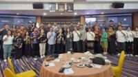
The Ministry of Marine Affairs and Fisheries (KKP), together with the Maluku Provincial Marine and Fisheries Agency and the Yayasan Konservasi Alam Nusantara (YKAN), held a three-day introductory training program for Community Monitoring Groups, locally known as Kelompok Masyarakat Pengawas (Pokmaswas), from 23 to 25 September 2026.
Held at the Lesluru Village Hall in Teon Nila Serua (TNS) District, the training was designed to strengthen local capacity to monitor marine activities, record and document observations at sea, and contribute to conservation-area management through the use of technology.
I Nyoman Radiarta, Head of KKP’s Agency for Marine and Fisheries Human Resources Development and Extension (BPPSDM KP), said local communities are important partners for the government in safeguarding marine and fisheries resources.
He said standardized training is needed to ensure that Pokmaswas members understand their roles and responsibilities, are able to identify potential violations, and can provide information that can be followed up by authorized authorities.
“Communities are important partners for the government in protecting marine and fisheries resources. Through standardized training, Pokmaswas members are expected to understand their roles and authorities, identify violations, and provide information that can be followed up by the relevant authorities,” Nyoman said.
He added that strengthening community-based monitoring is also linked to KKP’s blue economy agenda, particularly efforts to expand and improve the effectiveness of marine conservation areas and strengthen monitoring across coastal areas and small islands.
Indonesia currently has approximately 30.9 million hectares of conservation areas, with the government targeting an expansion to 97.5 million hectares by 2045.
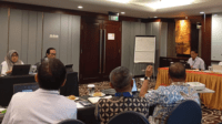
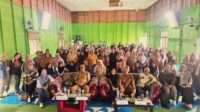
More than 40 participants took part in the TNS training. In addition to Pokmaswas members, the program brought together representatives of the TNS traditional council, women’s groups and the sub-district government.
The involvement of traditional institutions and other community representatives was intended to build a shared understanding of conservation-area monitoring while connecting formal conservation measures with customary rules and established local practices for using marine resources.
A 683,826-Hectare Conservation Area
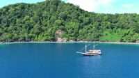
The Teon, Nila and Serua Islands Aquatic Conservation Area covers 683,826.89 hectares. It was formally designated through Ministerial Decree No. 67 of 2026, issued by the Ministry of Marine Affairs and Fisheries on 2 September 2026.
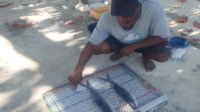
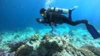
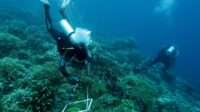
The area contains a range of important marine ecosystems and habitats, including coral reefs, seagrass meadows, fish spawning grounds and habitats for various marine species, including hammerhead sharks.
The scale and archipelagic character of the area underscore the importance of community involvement in monitoring. Long distances between islands, limited transportation and communication access mean that conservation monitoring cannot rely solely on the physical presence of government enforcement personnel.
Local communities therefore occupy a strategic position because they live closest to the waters being monitored and possess knowledge of the marine environment surrounding their islands.
The training was based on KKP’s Introductory Pokmaswas Training Module, which provides a common learning framework covering Pokmaswas institutional arrangements, conservation of aquatic ecosystems and species, operational monitoring procedures, and effective communication.
Joni Haryadi, Head of KKP’s Marine and Fisheries Training Center, said the participants were equipped not only with knowledge of monitoring functions but also with practical skills to prepare work plans, gather information and produce activity reports.
“The training does not only provide knowledge about monitoring, but also equips participants with the skills to develop work plans, collect information and prepare activity reports,” Joni said.
He expressed hope that each group would be able to apply the training according to the characteristics of its respective area while maintaining effective communication with monitoring agencies and conservation-area management units.
As part of the program, KKP and its partners also handed over official decrees recognizing four Pokmaswas groups. They are Pokmaswas Naworita from Teon Island, Asyalna and Lettelu from Nila Island, and Anser from Serua Island.
The formal recognition is part of an effort to strengthen the institutional foundation of Pokmaswas while providing a basis for continued capacity building so that the groups can carry out monitoring activities in a more structured manner.
Erawan Asikin, Head of the Maluku Provincial Marine and Fisheries Agency, said the recognition of the four groups was part of the provincial government’s efforts to strengthen community participation in conservation-area monitoring.
“The handover of the decrees to the four Pokmaswas groups is part of the Maluku Provincial Government’s effort to strengthen community involvement in monitoring the conservation area,” Erawan said.
Learning to Use Monitoring Technology
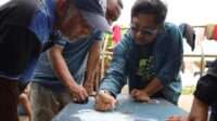
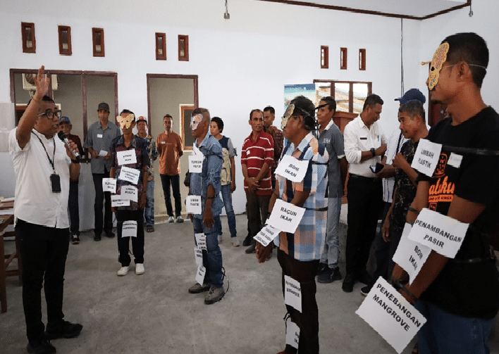
Over the three-day program, participants engaged in a range of learning activities, including presentations, discussions, group work, role-playing exercises and field simulations.
Training sessions were delivered by instructors from KKP’s Marine and Fisheries Training Center, the Ambon Marine and Fisheries Resources Monitoring Station, the Maluku Provincial Marine and Fisheries Agency, and YKAN.
One of the key sessions introduced participants to EarthRanger Mobile, an application designed to support patrol activities and record information gathered during field monitoring.
Participants learned how to use features such as location tracking, patrol recording and incident documentation. They then practiced using the application through group simulations to understand how it could be applied during routine monitoring activities.
The use of technology is expected to make the documentation of field observations more systematic. Information gathered by community monitors can also be shared with relevant agencies as part of the broader conservation monitoring system.
For communities that have traditionally relied on local experience and knowledge to understand changes in surrounding waters, the technology provides an additional tool for recording observations in a more structured way.
Esomi Anthony, a Pokmaswas participant, said local communities already have a strong familiarity with the waters around their islands. What they still need, however, is a better understanding of formal monitoring and reporting procedures.
“We have long understood the conditions of the sea around our islands, but we still need to learn how to conduct monitoring and report our findings properly,” Esomy said.
He hopes the knowledge gained through the training will help community groups carry out their work more systematically, particularly when they encounter activities that could threaten marine resources.
From Local Knowledge to a Monitoring System
Community participation is an important component of conservation management in archipelagic areas. Local knowledge of marine conditions, activity patterns, resources and changes in the sea can provide an important complement to government monitoring systems.
Muhammad Ilman, YKAN’s Director of Marine Programs, said communities in Teon, Nila and Serua possess extensive knowledge of the marine areas that have long been part of their everyday lives.
He said the training seeks to connect that local knowledge with technical skills in monitoring, documentation and the communication of information to the relevant authorities.
“Communities in Teon, Nila and Serua have knowledge of the marine areas and resources that have long been part of their lives. Through this training, we want to strengthen their ability to conduct monitoring, document findings and communicate information to the relevant authorities,” Ilman said.
He added that EarthRanger Mobile is one of the tools introduced to help record monitoring activities, allowing information collected in the field to contribute to conservation-area management.
Following the training, each Pokmaswas group is expected to develop a six-month monitoring work plan. The plans will be adapted to local conditions, the capacity of each group and the types of monitoring activities that communities are able to undertake.
The work plans are also expected to clarify coordination and reporting mechanisms with government agencies and conservation-area management units.
The strengthening of Pokmaswas in Teon, Nila and Serua therefore extends beyond formal recognition and technical training. The next step is to ensure that local knowledge, technical skills, technology and community participation can operate within a coordinated monitoring mechanism that responds to actual conditions in the field.