


Surprising Realities of the World’s Most Fragile Lifeline
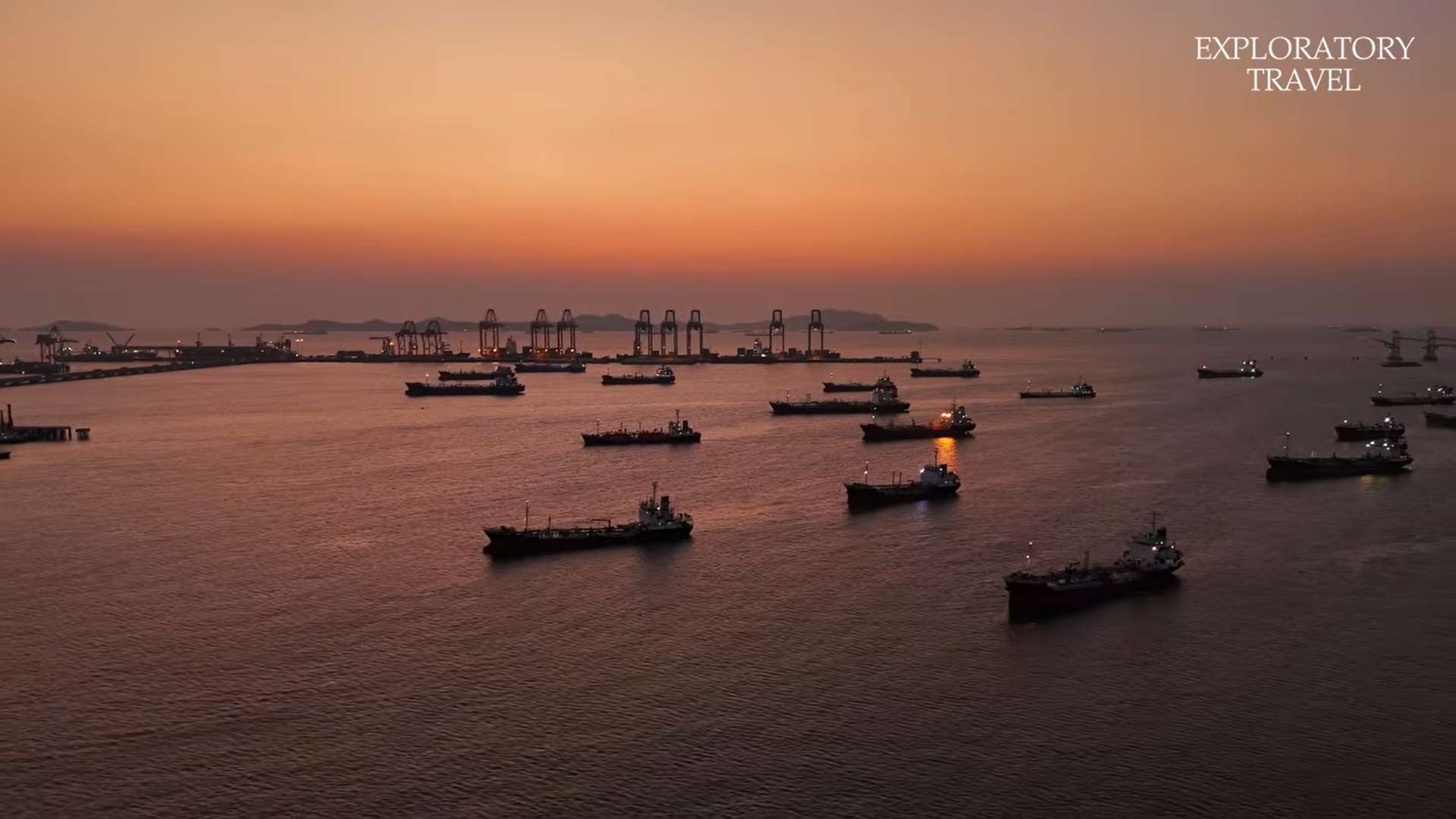
MARITIMEPOSTS.COM – The Strait of Hormuz is often described as the “jugular vein of humanity,” a narrow passage only 21 miles wide that carries nearly 20% of the global oil supply.
Every movement in this fatal intersection is scrutinized by world strategists, as even a slight fracture in its operation could trigger a global catastrophe. Beyond the daily transit of 20 million barrels of oil, however, lies a world shaped by violent tectonic tremors and ancient human adaptation.
This region is a hidden masterpiece of surreal geology and resilient cultures where human ambition for power collides with the active forces of the earth. We are invited to look past the geopolitical headlines to discover a textured civilization that has thrived on the edge of habitability for millennia.
These islands represent not just a strategic choke point, but an environment where survival is an accumulated intelligence passed down through generations.
The Island Where Geology is an Ingredient (Hormuz Island)
Hormuz Island is defined by a “salt diaper,” a 600-million-year-old mass of minerals and volcanic rock pressing upward through the earth. This geological phenomenon has created a surreal landscape featuring over 70 distinct mineral shades, including deep crimson cliffs and silver-black beaches ground from crystallized hematite.
The forces that built this environment remain active today, constantly reshaping the surface that 3,000 residents call home.
In a remarkable display of adaptation, the local population uses the environment as a resource for daily life. Women grind the red ochre soil, locally known as Gellac, into a spice for flavoring bread and stews, turning mineral survival directly into culinary identity. However, this same geology renders groundwater biologically unusable, creating a permanent structural dependency where every liter of drinking water must arrive by boat or desalination plant.
The island’s history is visible in the dissolving walls of the 16th-century Portuguese fort, which was built from the same red stone it sits upon.
“The island has always been in the process of reclaiming what empires attempted to fix in place.”
Engineering Without Blueprints (Qeshm Island)
Qeshm is the largest island in the Persian Gulf and holds the distinction of being the only UNESCO Global Geopark in the Middle East. It sits at the collision boundary of the Arabian and Eurasian tectonic plates, a 25-million-year compression that has produced salt cathedrals and the longest salt cave on Earth. For the 148,000 people living here, the landscape is the foundation of a working life conducted in the Bandari dialect, which carries traces of Portuguese, Hindi, and Swahili.
One of the island’s most significant traditions is the building of “Lenje” boats, an intangible heritage craft where oceangoing wooden vessels are assembled entirely from memory.
Cultural adaptation is also visible in the “borger,” a beaked mask worn by women as functional protection against the constant UV exposure and salt winds of the open water. These tools and techniques represent a sophisticated human response to an environment where the elements are occupational hazards.
Reflecting on this heritage reveals a poignant contrast between tectonic time and the human scale. While the geology of Qeshm has shifted over millions of years, the memory-based engineering of the Lenje is vanishing in a single generation as the youth seek mainland employment.
Invisibility as a Preservation Strategy (Larak Island)
Larak Island experiences extreme thermal swings, with temperatures ranging from 50°F on winter nights to over 110°F during the summer.
The island is famous for its natural bioluminescence, where concentrated phytoplankton produce waves of cold blue-green light along the shore. For the local fishing community, this light is a practical signal, as the density of the bloom correlates with conditions that concentrate the schooling fish they depend on.
Unlike its neighbors, Larak has remained relatively untouched by commercial development due to its proximity to sensitive strategic infrastructure.
This “invisibility” has inadvertently served as a highly effective conservation strategy, protecting the island’s reefs and culture from the destruction that often accompanies visibility and tourism. Homes here continue to be built from coral aggregate and earth, with thick walls designed to manage thermal stress through architectural logic rather than mechanical cooling.
The case of Larak suggests that being hidden behind geopolitical barriers can preserve ecological purity. By remaining a “way point” on strategic charts rather than a destination on travel brochures, the island has maintained an environment that is largely undiluted by coastal pollution.
The Silver Beach and the Zar Ceremony (Hengam Island)
The shoreline of Hengam Island is characterized by a metallic appearance caused by filicilicate mineral deposits in the sand. These deposits catch and scatter sunlight with such intensity that the beaches read as silver or near-white depending on the angle of the sun. The island supports a small community where adaptation has produced a unique cultural economy, including some of the only female fisherwomen in the Persian Gulf.
The community maintains its resilience through the “Zar ceremony,” a ritual involving hypnotic drumming and collective trance. This practice functions as a method of psychological recalibration for those living under the stress of isolation and a harsh climate. It is a form of collective care that predates modern medicine, showing how deeply these small populations are embedded in their specific environments.
This isolation breeds specialized forms of resilience, from the artisans who convert shell waste into jewelry to the fishers who work the lines before dawn.
The reliance on traditional rituals highlights a society that views its environment not as a series of resources to be extracted, but as a space to be inhabited.
Nature’s Most Effective Security System (Shidvar Island)
Shidvar Island remains uninhabited and pristine due to its dense population of Persian-horned vipers. This biological presence earned the location the name “Snake Island,” as the risk of envenomation serves as a powerful deterrent to human landing. This natural security system is far more effective than any administrative regulation, as it is a defense that humans cannot override with ambition.
The presence of the vipers has created an accidental sanctuary for the critically endangered Hawksbill sea turtle. Because humans avoid the beaches, the turtles are able to nest in an undisturbed environment, returning annually to the specific coordinates where they were hatched. However, a new invisible threat has emerged: warming Gulf waters are altering the thermal gradients that determine turtle sex ratios, skewing the population toward females.
There is a profound irony in the fact that the most dangerous places for humans are often the safest havens for biodiversity. Yet Shidvar reminds us that even the most effective biological defenses are vulnerable to the “thermal excess” of a changing global climate.
A Lake That Bleeds a Warning (Lake Urmia)
Lake Urmia has undergone a tragic transformation from a massive inland sea to a seasonal red brine or white salt flat visible from orbit. The lake’s startling color change is driven by Dunaliella algae, which produce red pigments as a photoprotective response to extreme salinity. This creates a literal color metaphor for ecological distress, signaling that the biological foundations of the lake are reaching a breaking point.
The decline was accelerated by modern infrastructure, specifically 14 dams and a six-lane highway causeway built in 2008 that disrupted the lake’s circulation. This rapid destruction contrasts sharply with a 3,000-year history of local agricultural success that once relied on the lake’s stable water table. Today, former marinas stand on dry salt plains, and boat docks end in mid-air, marking the site of a lost geography.
“The lake serves as a biological warning signal encoded directly in color.”
Conclusion: Learning from the Edge of Habitability
The islands of the Persian Gulf and the salt flats of Lake Urmia represent a textured civilization built on salt, coral, and memory. They are far more than geopolitical pressure points; they are environments where humans have learned to coexist with extreme fragility and structural dependencies. From the boat-delivered water of Hormuz to the thermal logic of Shidvar’s turtles, these locations are early documents of a future that is arriving everywhere.
Modern society can learn much from these communities about resilience and the accumulated intelligence of generations. They demonstrate that extreme conditions are not necessarily a crisis to be managed, but a condition to be inhabited. As environmental pressures mount globally, the specialized knowledge of those living at the edge of habitability becomes a universal necessity.
What can we learn from those who view the harshest minerals not as a barrier to life, but as the very foundation of a home?
Sources